The Mohammed bin Rashid Space Centre has announced a successful advancement in technology utilizing artificial intelligence to accurately monitor and count date palm trees, achieving an impressive accuracy rate of around 94%. This innovative technique was applied in the Al Ain region to survey over 4 million date palms, as part of a project that integrates technology with environmental efforts, contributing to better agricultural resource management and sustainability.
Food Security
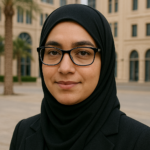
Fatima Al Marzouqi, a programming engineer at the centre, highlighted that this achievement marks a significant shift towards digital transformation in the agricultural sector. It supports national initiatives aimed at enhancing food security and the application of technology in agricultural development. She noted that the centre employs advanced AI techniques to process and analyze satellite images captured by its array of satellites, including the Mohammed bin Zayed Satellite and the radar satellite UnionSAT, with the goal of extracting precise data related to infrastructure and the environment.
The centre has recently launched an upgraded version of its geographic data analysis platform, which relies entirely on AI technologies to monitor and analyze geographical features. This advancement aids in providing accurate and comprehensive solutions that support decision-makers in urban planning and environmental sustainability.
Accurate Mapping
Additionally, the centre has developed another sophisticated AI technology designed to identify flood locations and create precise maps of affected areas through satellite imagery analysis. This capability provides critical information in a timely manner for crisis management and aids in the appropriate response to natural disasters, emphasizing the important role of the centre in utilizing space sciences for sustainable development and enhancing readiness in addressing climate challenges.
Previously, the Mohammed bin Rashid Space Centre reported that 67% of its satellite data is dedicated to environmental services, which are utilized for monitoring climate changes, tracking air quality, and analyzing land usage, in addition to supporting national efforts against desertification and monitoring vegetation cover.
The KhalifaSat satellite contributes 25% of the total data used for supporting and monitoring environmental services, boasting high-resolution imaging capabilities that enable it to accurately detect environmental changes, such as sand encroachment, coastal erosion, and the increase of green areas. The satellite also plays a crucial role in monitoring water quality and marine pollution, with its data being instrumental for climate studies and providing accurate information for stakeholders involved in environmental and urban planning, facilitating decision-making for sustainable development.
According to the latest statistics, the satellite data released by the centre over the years has enabled more than 30 entities to benefit from vegetation cover maps within the country, while over 25 entities have utilized information for coastal studies.
Addressing Challenges
The data gathered from the centre’s satellites has significantly contributed to executing 88 specialized studies in crisis and disaster management throughout 2024, reflecting the growing role of space technologies in supporting national efforts to tackle emerging challenges.
It is anticipated that the Mohammed bin Zayed Satellite and UnionSAT will play a pivotal role in enhancing the UAE’s capabilities in environmental monitoring using advanced space technologies. The Mohammed bin Zayed Satellite is one of the most advanced satellites in the region, featuring exceptional imaging precision and capabilities for data collection and analysis, making it an effective tool for studying environmental changes with high accuracy, such as tracking vegetation cover changes, monitoring pollutants, and analyzing climate change impacts.
On the other hand, UnionSAT is the UAE’s first satellite of its kind operating with Synthetic Aperture Radar (SAR) technology, which allows it to capture images in all weather conditions, day and night, even amidst clouds and dust. This capability will enhance the centre’s ability to provide continuous and uninterrupted environmental data, aiding decision-makers and contributing to the formulation of more precise and sustainable environmental policies.